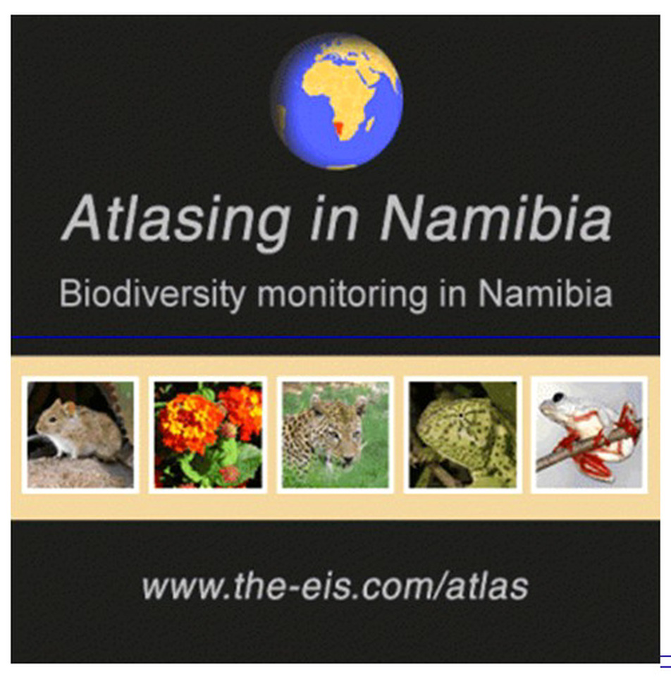
“Atlasing” Namibia is a fascinating digital project run by scientists and researchers and lay people can contribute to it.
According to environmental scientist Alice Jarvis, who is involved in this project, run by the Environmental Information Service (EIS), “citizen science” is the collection and analysis of data relating to the natural world by members of the general public, typically as part of a collaborative project with professional scientists”.
“Data sets collected through public participation are a valuable way to learn more about the distribution of species. Previous examples of citizen science projects in Namibia include the Southern African Bird Atlas Project, the Tree Atlas Project, bird ringing, raptor road counts, and the giraffe spotter initiative, Jarvis recently wrote in an article for Conservation Namibia of the Namibia Chamber of Environment (NCE).
The Atlasing project builds on previous Atlasing projects such as the Southern African Bird Atlas Project (SABAP) and Namibia’s Tree Atlas Project (TAP).
According to Jarvis, data sets collected through public participation are “a valuable way to learn more about the distribution of species”.
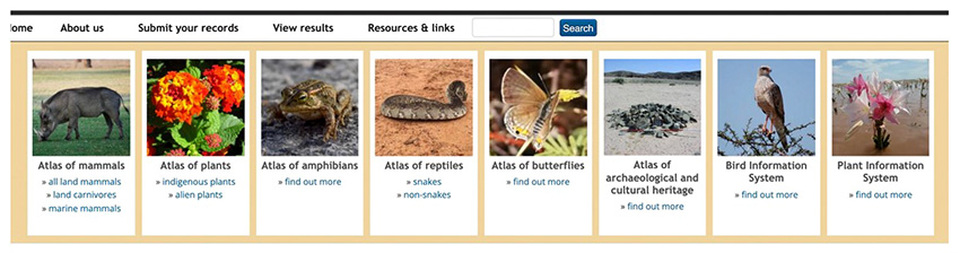
Data can be submitted from live sightings, dead animals killed along the road, migratory birds killed by power lines, photographs, camera traps, telemetry, spoor and any other records. The digital atlas project has different categories (see below):
Opening these pages, one finds a wealth of information about each species including photos, which make a fascinating read either as preparation for one’s trip or while travelling. (That is also quite useful to keep children busy on long roads). No need to carry along a hefty printed guide book.
Apart from the fauna and flora atlas, the one with archaeological sites and cultural heritage is quite unique and a favourite among many users.
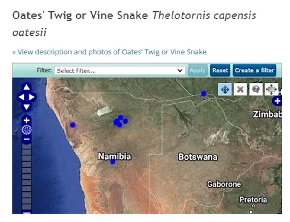
One can also check the latest sightings of that rare butterfly or a specific desert plant in bloom after surprise rains with precise GPS on an interactive map.
Data sets form part of the digital atlas
“By bringing Namibia’s biodiversity data together, we can enhance their value and usefulness. Comparisons become possible across space and time, between and across species. To this end, several substantial datasets have been incorporated into the Atlasing in Namibia system,” says Jarvis.
The online availability enables Namibia lovers, students and the interested public worldwide to learn more about Namibia’s environment.
The data sets include the Carnivore Atlas with data from 1995 – 2005, records from the Moewe Bay wardens over thirty years from 1979 to 2009, game counts in conservancies and concessions between 2002 and 2022 as well as research projects and farm data sets among others.
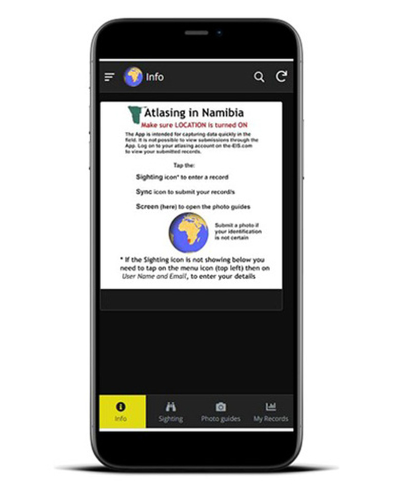
Download the app and get started
The Atlasing in Namibia app has been developed for android and apple devices and can be downloaded from Play Store and iOs. After installation one needs to allow it to have access to the location and camera of the device of the user. The new icon “atlasing” will be visible on the display.